
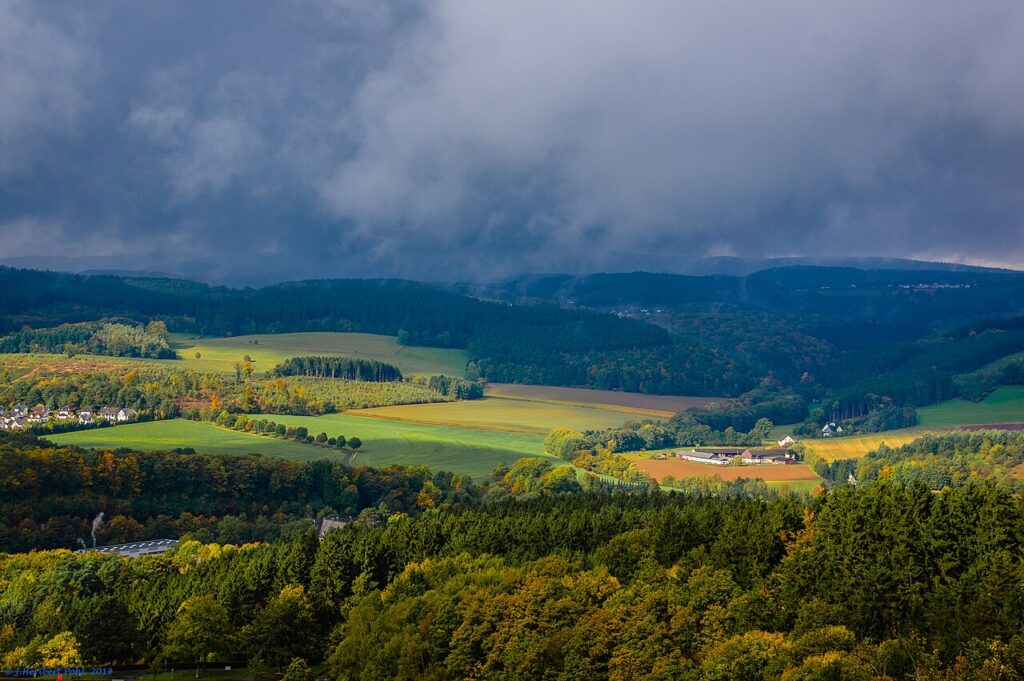
The Sauerland rises in low, forested ridges east of the Rhine and south of the Ruhr industrial belt, a landscape of beech-covered hills, reservoir lakes, and limestone formations that have been drawing German families for generations. It’s close enough to Cologne and Dortmund for a weekend escape, yet feels a world away from the cities.
This is walking and cycling country, with trails that wind along ridgelines and through valleys, past half-timbered villages and water sports centers. The caves are the region’s signature attraction, carved by underground rivers and open to visitors year-round.
The Limestone Caves
The Atta Cave near Attendorn is the most visited, a labyrinth of stalactites and flowstone discovered in 1907 during railway construction. Guided tours descend 80 meters below ground through chambers named for their shapes—the Crystal Palace, the Hall of Columns. The temperature stays around 9°C, so bring a jacket even in summer.
Further west, the Dechenhöhle in Iserlohn offers similar formations on a slightly smaller scale, with tours that last about 40 minutes. Both caves require advance booking during school holidays.
Reservoir Lakes and Water Sports
The Sauerland’s valleys were dammed throughout the 20th century to supply the Ruhr cities with drinking water, creating a chain of reservoirs that now serve as swimming and sailing destinations. Biggesee, the largest, stretches 8 kilometers between wooded slopes. Passenger boats run from Attendorn to Sondern, stopping at swimming beaches and rental docks along the way.
Sorpesee is quieter, popular with windsurfers and stand-up paddleboarders. The loop trail around the lake takes about three hours on foot, with cafés at the dam and at Langscheid village. Wild swimming is allowed in designated areas; the water is cold but clean.
Ridge Trails and Upland Villages
The Rothaarsteig is the region’s long-distance footpath, running 154 kilometers from Brilon to the Westerwald. Day hikers can pick up sections near Winterberg or Willingen, where the trail crosses open heathland and offers views toward the Hochsauerland peaks. Waymarking is excellent, with the route’s white “W” symbol on every junction.
Winterberg itself is better known as a ski resort, but in summer the lifts carry mountain bikers to the top of the Kahler Asten, the region’s highest point at 841 meters. The observation tower up top gives you a panorama of the entire upland plateau.
Villages like Schmallenberg and Hallenberg preserve their timber-frame centers, with inns that serve Sauerland pot roast and smoked ham. Hallenberg’s old town sits on a hill, its medieval walls still intact.
Getting There and When to Visit
Trains from Dortmund reach Attendorn in about 90 minutes; from Cologne, change at Hagen. Drivers can use the A45 and A46 autobahns to reach most of the region in under two hours from the Rhine-Ruhr metro areas.
Spring and autumn are ideal for hiking, with fewer crowds and forest colors. Summer weekends bring families to the lakes; book accommodation early. Winter transforms Winterberg and Willingen into modest ski areas, with cross-country trails throughout the hills.
The Sauerland doesn’t have the drama of the Alps or the wine-town romance of the river valleys, but it offers space, forest air, and trails where you can walk for hours without seeing another soul.
We send one short story about Germany every day to thousands of subscribers. Join us and get yours—subscribe to the Love Germany newsletter and see the country through fresh eyes.
Tours & experiences in Germany


Powered by Viator. Some links are affiliate links — we may earn a small commission at no extra cost to you.